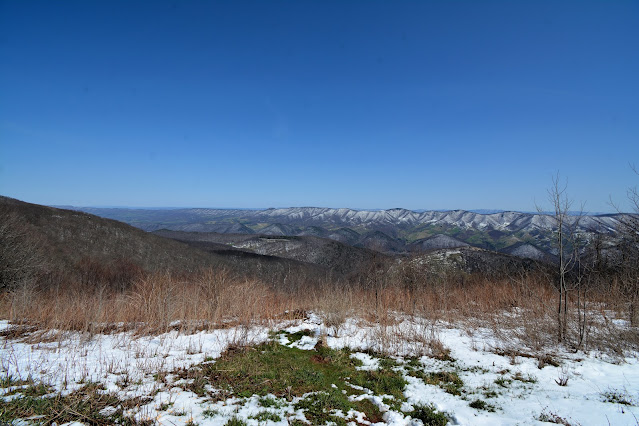
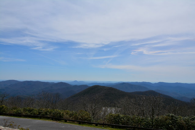
Scenery Around Spruce Knob, West Virginia

Scenery Around Spruce Knob, West Virginia

Saturday, April 23, 2022

SPRUCE KNOB, WEST VIRGINIA


Scenery around Spruce Knob


The latitude and longitude coordinates (GPS waypoints) of the summit of Spruce Knob are 38.699756 (North), -79.532993 (West) and the approximate elevation is 4861 feet (1482 meters) above sea level. Spruce Knob ranks 24th in height on the list of highest natural points in each state. Spruce Knob is also the highest point on the Allegheny Mountains. Located in Pendleton County.

Directions to Spruce Knob: In Seneca Rocks, take WV-28s/WV-55W and follow for about 10 miles, then turn right onto Briery Gap Run Rd. After about 2.4 miles continue onto FR 112. Follow FR 112 for about 7.4 miles until you reach the intersection with FR 104. Take a right onto FR 104 at the intersection and follow for about 1.6 miles to the observation tower. From there it is a short 100 yrds to the summit.

BACKBONE MOUNTAIN - MARYLAND


The latitude and longitude coordinates (GPS waypoints) of the summit of Backbone Mountain are 39.237398 (North), -79.485528 (West) and the approximate elevation is 3360' feet (1024 meters) above sea level. Backbone Mountain ranks 32nd in height on the list of highest natural points in each state. Located just inside of Maryland, bordering West Virginia, in Garrett County, the summit, called Hoye-Crest is the highest point on Backbone Mountain. The location, is named Captain Charles Hoye, founder of the Garrett County Historical Society.
The location is accessible via a short, and difficult, and steep 1.2 mile path, leading from U.S. Route 219 to the west. To get to the trailhead, take U.S. Route 219 from Silver Lake, West Virginia drive south for a little over one mile. There is a sign stating Maryland's high point, there are parking places on both sides of the road in that location. Look for the old logging road, from there you will follow signs and orange guiding blazes.

MOUNT DAVIS - PENNSYLVANIA


Scenery around the summit


The latitude and longitude coordinates (GPS waypoints) of the summit of Mount Davis are 39.786009 (North), -79.176802 (West), and the approximate elevation is 3213' (979 meters) above sea level. Mount Davis ranks 33rd in height on the list of highest natural points in each state. It is located in the Forbes State Forest in Elk Lick Township, Somerset County, Pennsylvania. 
The high point was named for John Nelson Davis, an early settler, American Civil War veteran, surveyor, and naturalist known for his studies of the mountain's flora and fauna. During the Civil War, Davis served in Company e, 102nd Pennsylvania Infantry. 
The summit road is a little over a mile from S. Wolf Rock Rd, the parking lot sits adjacent to the summit site.


Friday, April 8, 2022

BRASSTOWN BALD MOUNTAIN- GEORGIA


 The latitude and longitude coordinates (GPS waypoints) of the summit of Brasstown Bald Mountain are 34.874361 (North), -83.811077 (West) and the approximate elevation is 4,784 feet ( 1,458 meters) above sea level. Brasstown Bald ranks 25th in height on the list of highest natural points in each state. It is located in the northeastern part of the state on the Blue Ridge Mountains on the border between Towns and Union counties south of the city of Hiawassee.

One can drive to the base of the mountain, and at that time you can decide to walk up a moderate .6 mile incline to the summit, or there are shuttle buses to take you if desired.

Wednesday, April 6, 2022

SASSAFRAS MOUNTAIN - SOUTH CAROLINA


Scenery around Sassafrass Mountain


The latitude and longitude coordinates (GPS waypoints) of the summit of Sassafrass Mountain are 35.065147 (North), -82.777349 (West) and the approximate elevation which has been recently updated by the South Carolina Geological Survey assessment, is 3,533 feet (1,077 meters) above sea level. Sassafrass Mountain ranks 29th in height on the list of highest natural points in each state. It is located in Pickens County, South Carolina.

The road to the summit, Sassafrass Mountain Rd., going south from Folly Gap, is a very steep, approximate 2.5 mile road. When you reach the parking lot, it will be a steep 2-300' walk to the summit.